Sols 4164-4165: What’s Around the Ridge-bend?

Sols 4164-4165: What’s Around the Ridge-bend?

2 min read

Sols 4164-4165: What’s Around the Ridge-bend?

Gediz Vallis ridge
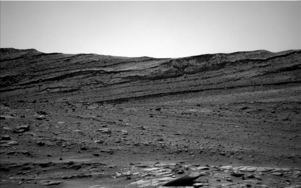
This image was taken by the Left Navigation Camera and looks towards the deposits that make up the bend in Gediz Vallis ridge between “Pinnacle Ridge” and “Fascination Turret”. In the background is the layered stratigraphy that makes up the butte “Texoli”.
NASA/JPL-Caltech

Earth planning date: Monday, April 22, 2024  

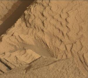
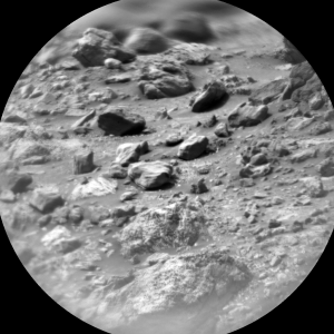
Curiosity succeeded on a ~14 m drive along a bend in upper Gediz Vallis ridge (uGVR) to park next to “Pinnacle Ridge,” an outcrop of uGVR to the north. Benefitting from a surplus in power, Curiosity’s already substantial targeted science block was extended to 2 hours. This allowed for the perfect imaging opportunity to look back and investigate the ridge deposits between “Pinnacle Ridge” and “Fascination Turret,” an outcrop of uGVR to the south. In other words, most of the imaging opportunities in this two-sol plan will be spent documenting what’s just around the ridge-bend with a detailed Mastcam stereo-mosaic and two ChemCam Long Distance RMI mosaics.

Today I served as Keeper of the Plan for the Geology and Mineralogy Theme Group, where I was kept busy recording all of the geology related requests from the instrument teams. The first sol involved planning contact science on a nearby dark-toned float block, “Sluggo Pass,” possibly originating from Gediz Vallis ridge. The composition and sedimentary textures of “Sluggo Pass” will be investigated with the Alpha Particle X-Ray Spectrometer (APXS), a ChemCam passive raster, and the Mars Hand Lens Imager (MAHLI). While constraints prevented brushing “Sluggo Pass” with the Dust Removal Tool (DRT), the target appeared to be relatively dust-free. The rest of the science plan on the first sol includes a ChemCam Laser-Induced Breakdown Spectroscopy (LIBS) targeting a dark-toned coating on light-toned bedrock, dubbed ‘South Lake,’ and two small Mastcam mosaics on blocks possibly associated with “Pinnacle Ridge.”

After a planned ~31 m drive from our current location, the focus of the second sol of the plan will be on untargeted remote science. This includes one of ChemCam’s automated AEGIS (Autonomous Exploration for Gathering Increased Science) activities where geological targets are automatically selected from the rover’s navigation cameras for analysis with ChemCam. Additionally, environmental activities were also planned, including tau observations to assess the amount of dust in the atmosphere and Mastcam deck monitoring activities to assess the amount of dust accumulated on the rover deck.

Written by Amelie Roberts, Graduate Student at Imperial College London

Share

Details

Last Updated
Apr 23, 2024

Powered by WPeMatico

Get The Details…

First NASA Mars Analog Crew Nears End of Mission

First NASA Mars Analog Crew Nears End of Mission

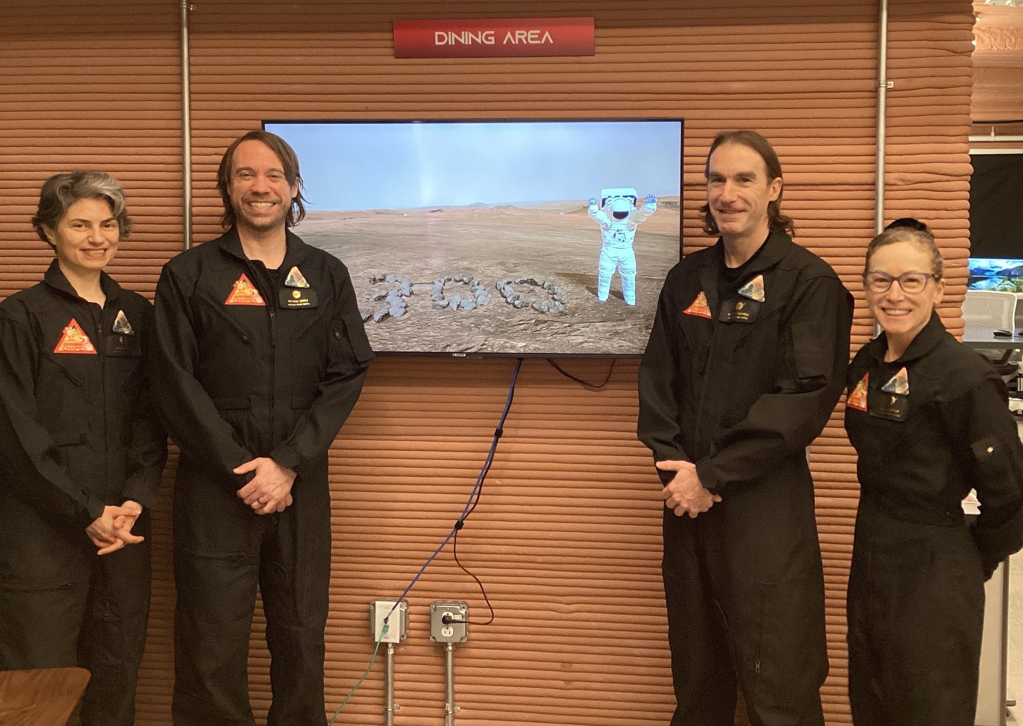
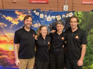
The inaugural CHAPEA crew marks 300 days inside the habitat on April 20, 2024 (from left: Anca Selariu, Nathan Jones, Ross Brockwell, Kelly Haston).
NASA/CHAPEA Crew

The first crew to take part in a yearlong NASA Mars analog mission reached the 300-day mark of its mission on April 20.

The team of four volunteers entered the CHAPEA (Crew Health and Performance Exploration Analog) habitat at NASA’s Johnson Space Center in Houston on June 25, 2023, and is expected to complete the mission on July 6, 2024.

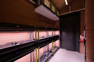
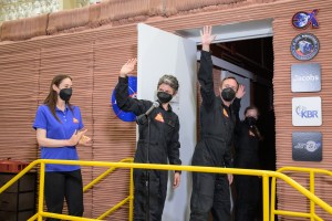
During their 300 days in the ground-based habitat, the crew engaged in multiple simulated “Marswalks,” grew and harvested several salad crops to occasionally supplement their shelf-stable food, and took part in habitat and equipment maintenance.

NASA is leading a return to the Moon for long-term science and exploration. Through Artemis missions, NASA will land the first woman, first person of color, and first international partner astronaut on the Moon, using innovative technologies to explore more of the lunar surface than ever before. Lessons learned on and around the Moon and activities like CHAPEA on the ground will prepare NASA for the next giant leap: sending astronauts to Mars.

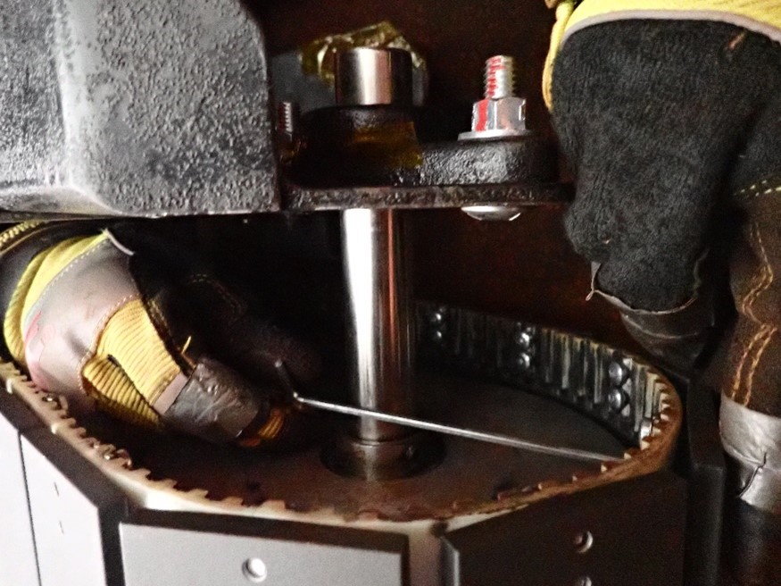
A CHAPEA mission 1 crew member performs maintenance on hardware outside of the habitat during a simulated spacewalk in December 2023.
NASA/CHAPEA Crew
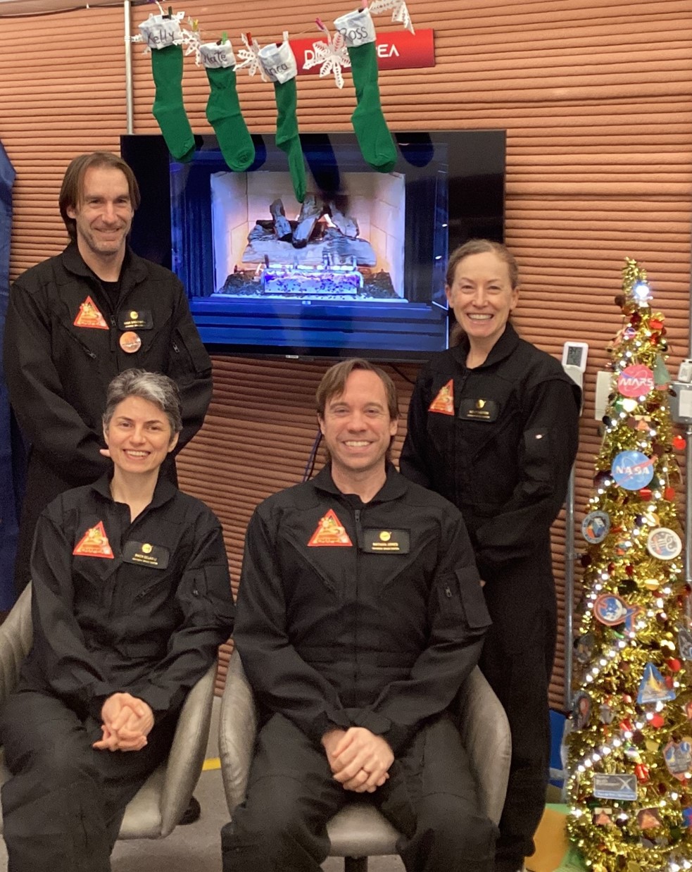
The CHAPEA mission 1 crew celebrates Christmas inside the habitat (from left: Ross Brockwell, Anca Selariu, Nathan Jones, Kelly Haston).
NASA/CHAPEA Crew
Inside the habitat, the CHAPEA mission 1 crew harvested a tomato.
Inside the habitat, the CHAPEA mission 1 crew harvested tomatoes.
NASA/CHAPEA Crew

Powered by WPeMatico

Get The Details…
Kelli Mars

NASA’s CloudSat Ends Mission Peering Into the Heart of Clouds

NASA’s CloudSat Ends Mission Peering Into the Heart of Clouds

Artist concept of NASA CloudSat spacecraft, which will provide the first global survey of cloud properties to better understand their effects on both weather and climate.
An artist’s concept shows NASA’s CloudSat spacecraft in orbit above Earth. Launched in 2006, it provided the first global survey of cloud properties before being decommissioned in March 2024 at the end of its lifespan.
NASA/JPL

Over the course of nearly two decades, its powerful radar provided never-before-seen details of clouds and helped advance global weather and climate predictions.

CloudSat, a NASA mission that peered into hurricanes, tallied global snowfall rates, and achieved other weather and climate firsts, has ended its operations. Originally proposed as a 22-month mission, the spacecraft was recently decommissioned after almost 18 years observing the vertical structure and ice/water content of clouds.

As planned, the spacecraft — having reached the end of its lifespan and no longer able to make regular observations — was lowered into an orbit last month that will result in its eventual disintegration in the atmosphere.

When launched in 2006, the mission’s Cloud Profiling Radar was the first-ever 94 GHz wavelength (W-band) radar to fly in space. A thousand times more sensitive than typical ground-based weather radars, it yielded a new vision of clouds — not as flat images on a screen but as 3D slices of atmosphere bristling with ice and rain.

For the first time, scientists could observe clouds and precipitation together, said Graeme Stephens, the mission’s principal investigator at NASA’s Jet Propulsion Laboratory in Southern California. “Without clouds, humans wouldn’t exist, because they provide the freshwater that life as we know it requires,” he said. “We sometimes refer to them as clever little devils because of their confounding properties. Clouds have been an enigma in terms of predicting climate change.”

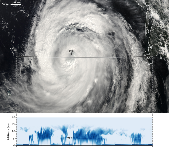
NASA’s CloudSat passed over Hurricane Bill near the U.S. East Coast in August 2009, capturing data from the Category 4 storm’s eye. This pair of images shows a view from the agency’s Aqua satellite (top) along with the vertical structure of the clouds measured by CloudSat’s radar (bottom).
Jesse Allen, NASA Earth Observatory

Clouds have long held many secrets. Before CloudSat, we didn’t know how often clouds produce rain and snow on a global basis. Since its launch, we’ve also come a long way in understanding how clouds are able to cool and heat the atmosphere and surface, as well as how they can cause aircraft icing.

CloudSat data has informed thousands of research publications and continues to help scientists make key discoveries, including how much ice and water clouds contain globally and how, by trapping heat in the atmosphere, clouds accelerate the melting of ice in Greenland and at the poles.

Weathering the Storm

Over the years, CloudSat flew over powerful storm systems with names like Maria, Harvey, and Sandy, peeking beneath their swirling canopies of cirrus clouds. Its Cloud Profiling Radar excelled at penetrating cloud layers to help scientists explore how and why tropical cyclones intensify.

In this animation, CloudSat’s radar slices into Hurricane Maria as it rapidly intensifies in the Atlantic Ocean in September 2017. Areas of high reflectivity, shown in red and pink, extend above 9 miles (15 kilometers) in height, indicating large amounts of water being drawn upward high into the atmosphere. Credit: NASA/JPL-Caltech/CIRA

Across the life of CloudSat, several potentially mission-ending issues occurred related to the spacecraft’s battery and to the reaction wheels used to control the satellite’s orientation. The CloudSat team developed unique solutions, including “hibernating” the spacecraft during nondaylight portions of each orbit to conserve power, and orienting it with fewer reaction wheels. Their solutions allowed operations to continue until the Cloud Profiling Radar was permanently turned off in December 2023.

“It’s part of who we are as a NASA family that we have dedicated and talented teams that can do things that have never before been done,” said Deborah Vane, CloudSat’s project manager at JPL. “We recovered from these anomalies with techniques that no one has ever used before.”

Sister Satellites

CloudSat was launched on April 28, 2006, in tandem with a lidar-carrying satellite called CALIPSO (short for the Cloud-Aerosol Lidar and Infrared Pathfinder Satellite Observation). The two spacecraft joined an international constellation of weather- and climate-tracking satellites in Earth orbit.

Radar and lidar are considered “active” sensors because they direct beams of energy at Earth — radio waves in the case of CloudSat and laser light in the case of CALIPSO — and measure how the beams reflect off the clouds and fine particles (aerosols) in the atmosphere. Other orbiting science instruments use “passive” sensors that measure reflected sunlight or radiation emitted from Earth or clouds.

Orbiting less than a minute apart, CloudSat and CALIPSO circled the globe in Sun-synchronous orbits from the North to the South Pole, crossing the equator in the early afternoon and after midnight every day. Their overlapping radar-lidar footprint cut through the vertical structure of the atmosphere to study thin and thick clouds, as well as the layers of airborne particles such as dust, sea salt, ash, and soot that can influence cloud formation.

The influence of aerosols on clouds remains a key question for global warming projections. To explore this and other questions, the recently launched PACE satellite and future missions in NASA’s Earth System Observatory will build upon CloudSat’s and CALIPSO’s legacies for a new generation.

“Earth in 2030 will be different than Earth in 2000,” Stephens said. “The world has changed, and the climate has changed. Continuing these measurements will give us new insights into changing weather patterns.”

More About the Missions

The CloudSat Project is managed for NASA by JPL. JPL developed the Cloud Profiling Radar instrument with important hardware contributions from the Canadian Space Agency. Colorado State University provides science data processing and distribution. BAE Systems of Broomfield, Colorado, designed and built the spacecraft. The U.S. Space Force and U.S. Department of Energy contributed resources. U.S. and international universities and research centers support the mission science team. Caltech in Pasadena, California, manages JPL for NASA.

CALIPSO, which was a joint mission between NASA and the French space agency, CNES (Centre National d’Études Spatiales), ended its mission in August 2023.

News Media Contacts

Jane J. Lee / Andrew Wang
Jet Propulsion Laboratory, Pasadena, Calif.
818-354-0307 / 626-379-6874
jane.j.lee@jpl.nasa.gov / andrew.wang@jpl.nasa.gov

Written by Sally Younger

2024-048

Powered by WPeMatico

Get The Details…
Naomi Hartono
Hubble Spots the Little Dumbbell Nebula

Hubble Spots the Little Dumbbell Nebula

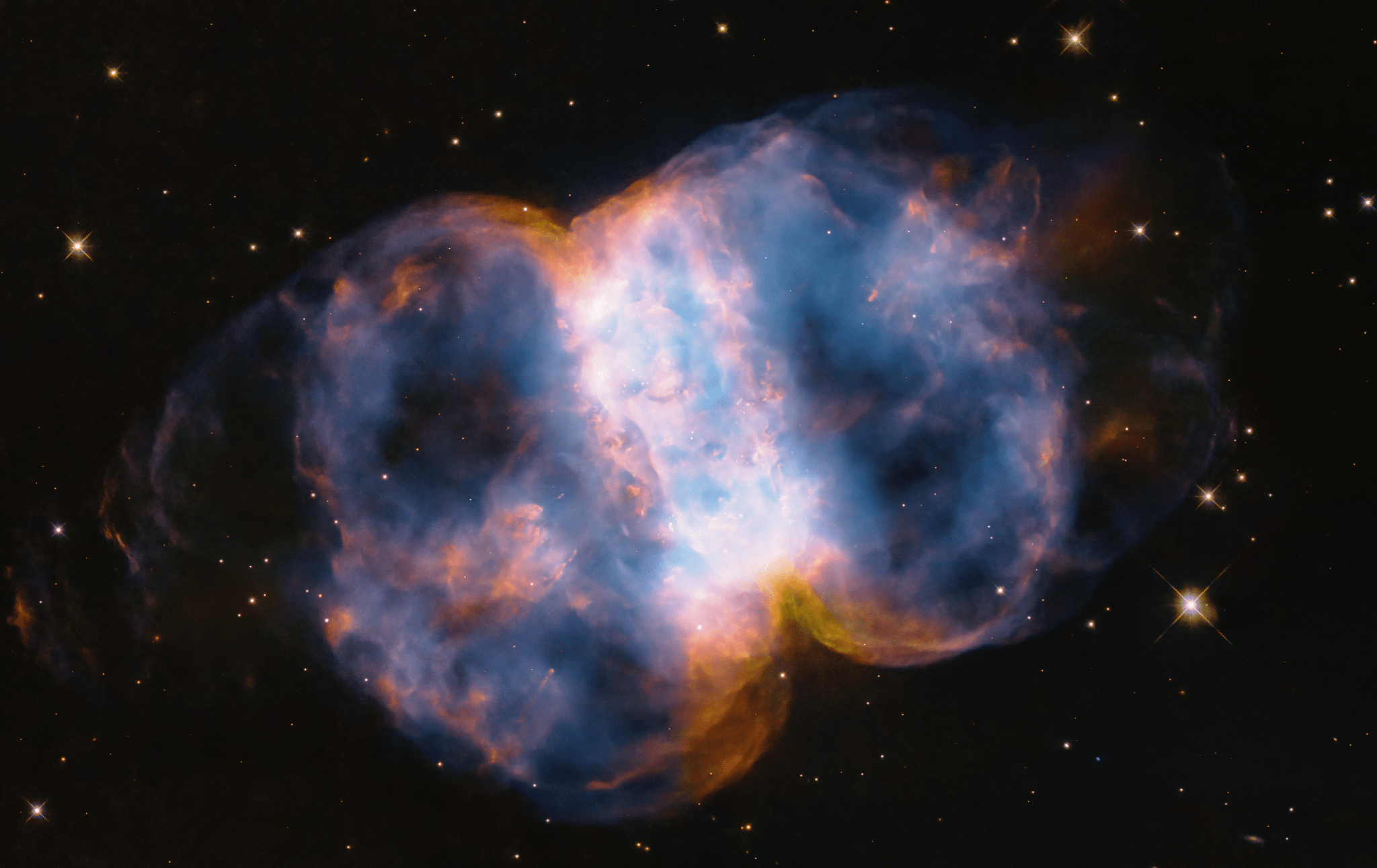
Taking up most of the image, is a multi-colored nebula in shades of blue, pink, yellow, orange, purple, and white. It appears as two translucent orbs attached by a white band.
In celebration of the 34th anniversary of the launch of NASA’s Hubble Space Telescope, astronomers took a snapshot of the Little Dumbbell Nebula, also known as Messier 76, or M76, located 3,400 light-years away in the northern circumpolar constellation Perseus. The name ‘Little Dumbbell’ comes from its shape that is a two-lobed structure of colorful, mottled, glowing gases resembling a balloon that’s been pinched around a middle waist. Like an inflating balloon, the lobes are expanding into space from a dying star seen as a white dot in the center. Blistering ultraviolet radiation from the super-hot star is causing the gases to glow. The red color is from nitrogen, and blue is from oxygen.
NASA, ESA, STScI

To celebrate the 34th anniversary of the Hubble Space Telescope’s launch, the telescope captured an image of the Little Dumbbell Nebula, or M76. M76 is a planetary nebula, an expanding shell of glowing gases that were ejected from a dying red giant star that eventually collapses to an ultra-dense and hot white dwarf. It gets its descriptive name from its shape: a ring, seen edge-on as the central bar structure, and two lobes on either opening of the ring.

Since its launch in 1990 Hubble has made 1.6 million observations of over 53,000 astronomical objects. Most of Hubble’s discoveries were not anticipated before launch, such as supermassive black holes, the atmospheres of exoplanets, gravitational lensing by dark matter, the presence of dark energy, and the abundance of planet formation among stars.

Learn more about the Little Dumbbell Nebula and Hubble.

Image Credit: NASA, ESA, STScI

Powered by WPeMatico

Get The Details…
Monika Luabeya

NASA’s Boeing Crew Flight Test Astronauts Enter Quarantine for Mission

NASA’s Boeing Crew Flight Test Astronauts Enter Quarantine for Mission

NASA's Boeing Crew Flight Test astronauts Suni Williams (left) and Butch Wilmore (right) pose for photo ahead of May 6 flight to the International Space Station
The official crew portrait for NASA’s Boeing Crew Flight Test. Left is Suni Williams, who will serve as the pilot, and to the right is Barry “Butch” Wilmore, spacecraft commander. Photo credit: NASA

NASA astronauts Butch Wilmore and Suni Williams, who are set to launch to the International Space Station on Monday, May 6, entered pre-flight quarantine in preparation for the agency’s Boeing Crew Flight Test mission.

Flight crew health stabilization is a standard process ahead of any human spaceflight mission to ensure the health and safety of the crew prior to liftoff, as well as prevent sickness of the astronauts at the space station. During quarantine, astronaut contact is limited, and most interactions are remote – although family and some launch team members also may be in quarantine or cleared before interacting with the crew.

Wilmore and Williams will launch aboard Boeing’s Starliner spacecraft on a ULA (United Launch Alliance) Atlas V rocket from Space Launch Complex-41 at Cape Canaveral Space Force Station in Florida as part of NASA’s Commercial Crew Program. The duo will make history as the first people to fly on the Starliner spacecraft.

Wilmore and Williams will quarantine at NASA’s Johnson Space Center in Houston before traveling to the agency’s Kennedy Space Center in Florida no earlier than Thursday, April 25, where they’ll remain in quarantine until launch.

Meanwhile, teams also are preparing for the Flight Test Readiness Review, which will take place over the course of two days – Wednesday, April 24, and April 25. That review brings together teams from NASA, Boeing, ULA, and its international partners to verify mission readiness including all systems, facilities, and teams that will support the end-to-end test of the Starliner.

Following a successful flight test, NASA will begin certifying the Starliner system for regular crew rotation missions to space station for the agency.

Launch is scheduled no earlier than 10:34 p.m. EDT May 6.

Learn more about NASA’s Boeing Crew Flight Test by following the mission blog, the commercial crew blog, @commercial_crew on X, and commercial crew on Facebook.

Learn more about station activities by following the space station blog, @space_station and ISS_Research on X, as well as the ISS Facebook and ISS Instagram accounts.

Powered by WPeMatico

Get The Details…

Elyna Niles-Carnes