


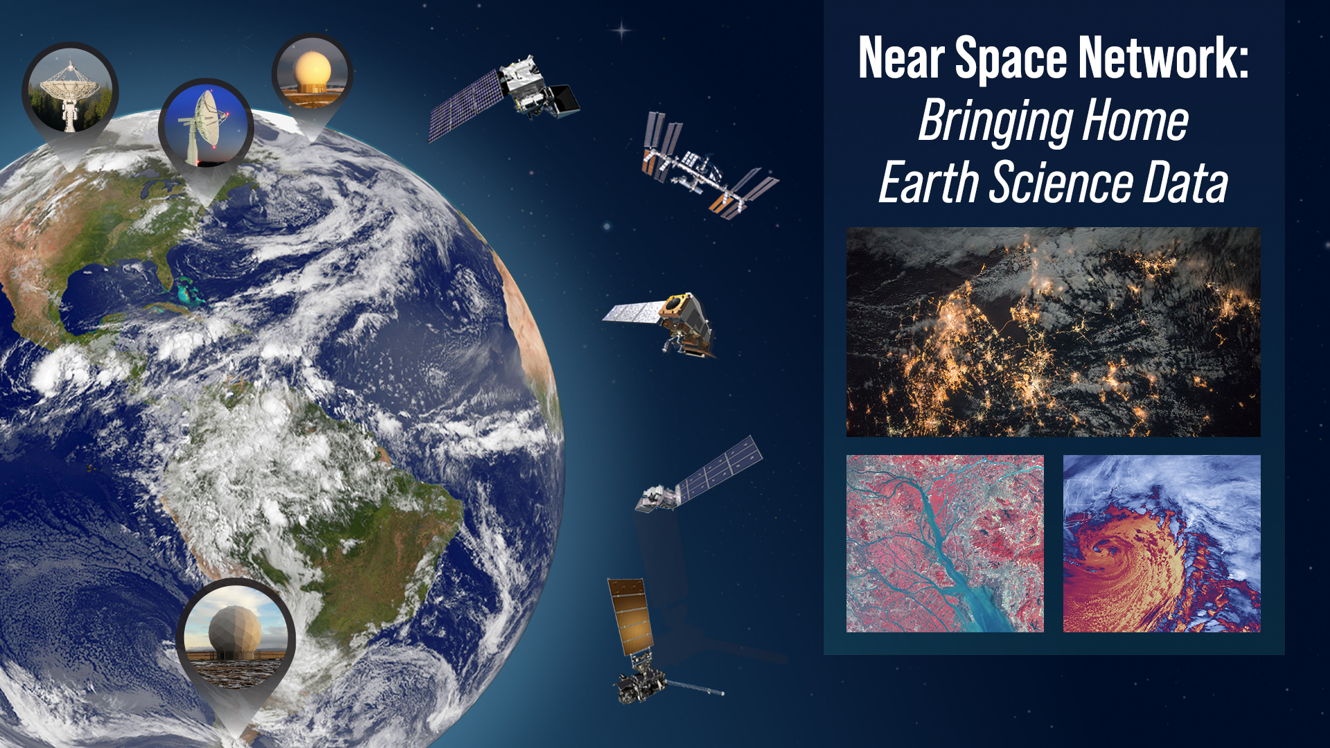
NASA’s Near Space Network Enables PACE Climate Mission to ‘Phone Home’
The PACE (Plankton, Aerosol, Cloud, ocean Ecosystem) mission has delivered its first operational data back to researchers, a feat made possible in part by innovative, data-storing technology from NASA’s Near Space Network, which introduced two key enhancements for PACE and other upcoming science missions.
As a satellite orbits in space, its systems generate critical data about the spacecraft’s health, location, battery life, and more. All of this occurs while the mission’s science instruments capture images and data supporting the satellite’s overall objective.
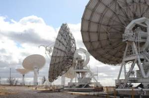
NASA/Kasey Dillahay
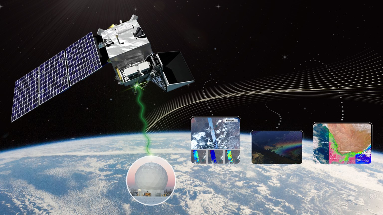
This data is then encoded and sent back to Earth via radio waves through NASA’s Near Space Network and Deep Space Network — but not without challenges.
One challenge is extreme distances, where disruptions or delays are common. Satellite disruptions are similar to what internet users experience on Earth with buffering or faulty links. If a disruption occurs, Delay/Disruption Tolerant Networking, or DTN, can safely store and forward the data once a path opens.
NASA’s Near Space Network integrated DTN into four new antennas and the PACE spacecraft to showcase the benefit this technology can have for science missions. The network, which supports communications for space-based mission within 1.2 million miles of Earth, is constantly enhancing its capabilities to support science and exploration missions.
DTN is the future of space communications, providing robust protection of data that could be lost due to a disruption.”

Kevin Coggins
Deputy Associate Administrator for NASA SCaN
“DTN is the future of space communications, providing robust protection of data that could be lost due to a disruption,” said Kevin Coggins, deputy associate administrator for NASA’s Space Communications and Navigation (SCaN) program. “PACE is the first operational science mission to leverage DTN, and we are using it to transmit data to mission operators monitoring the batteries, orbit, and more. This information is critical to mission operations.”
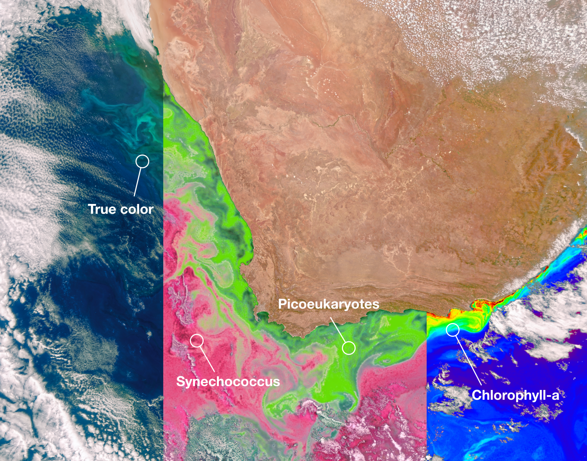
PACE, a satellite located about 250 miles above Earth, is collecting data to help researchers better understand how the ocean and atmosphere exchange carbon dioxide, measure atmospheric variables associated with air quality and climate, and monitor ocean health by studying phytoplankton — tiny plants and algae.
While PACE is the first operational science user of DTN, demonstrations of the technology have been done previously on the International Space Station.
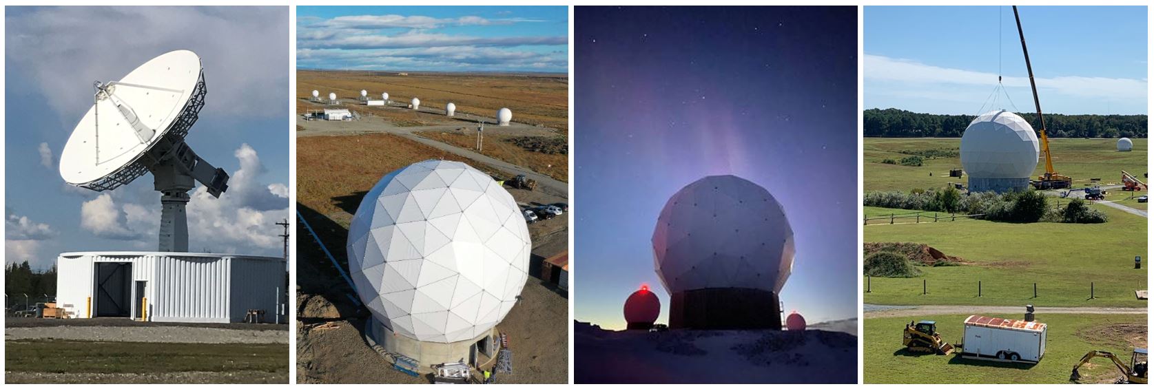
In addition to DTN, the Near Space Network worked with commercial partner, Kongsberg Satellite Services in Norway to integrate four new antennas into the network to support PACE.
These new antennas, in Fairbanks, Alaska; Wallops Island, Virginia; Punta Arenas, Chile; and Svalbard, Norway, allow missions to downlink terabytes of science data at once. Just as scientists and engineers constantly improve their instrument capabilities, NASA also advances its communications systems to enable missions near Earth and in deep space.
As PACE orbits Earth, it will downlink its science data 12 to 15 times a day to three of the network’s new antennas. Overall, the mission will send down 3.5 terabytes of science data each day.
Network capability techniques like DTN and the four new antennas are the latest enhancements to the Near Space Network’s catalog of services to support science missions, human spaceflight, and technology experiments.
“NASA’s Near Space Network now has unprecedented flexibility to get scientists and operations managers more of the precious information they need to ensure their mission’s success,” said Coggins.
In addition to these new capabilities, the network is also increasing the number of commercial antennas within its portfolio. In 2023, NASA issued the Near Space Network Services request for proposal to seek commercial providers for integration into the network’s expanding portfolio. With an increasing capacity, the network can support additional science missions and downlink opportunities.
The Near Space Network is funded by NASA’s Space Communications and Navigation (SCaN) program office at NASA Headquarters in Washington and operated out of NASA’s Goddard Space Flight Center in Greenbelt, Maryland.
By Katherine Schauer
NASA’s Goddard Space Flight Center, Greenbelt, Md.
About the Author
Katherine Schauer
Katherine Schauer is a writer for the Space Communications and Navigation (SCaN) program office and covers emerging technologies, commercialization efforts, exploration activities, and more.
Share
Details
Related Terms
NASA’s Near Space Network Enables PACE Climate Mission to ‘Phone Home’
NASA/Kasey Dillahay
Explore More

Powered by WPeMatico
Get The Details…
Katherine Schauer
